Saturday, September 29, 2012

Post hike: Eagle Creek Alternate Route

One of our goals when we set out to hike the PCT was to stay on the official trail, no flips, no skips, no alternate routes. That meant we hiked the official trail to Cascade Locks, Oregon, not the more popular Eagle Creek alternate route.

An estimated 98% of PCT hikers take the Eagle Creek alternate route, not the official PCT, and with good reason. The alternate route is far more scenic, and has easier access to water.

After a night at trail angel Shrek's house (aka "Shrek's Swamp"), we headed for Eagle Creek.  The trail parallels Eagle Creek as it climbs the sometimes narrow, forested canyon. We climbed past tall, moss covered trees, along mossy rocks and ground. At times the canyon narrowed and our trail became a ledge along the steep rock wall, with vertical rock rising above and a sheer drop off to the water below.

We passed Punchbowl Falls, looking down as the water poured from its rocky spout into a waiting bowl-shaped pool. Then we climbed up to High Bridge, which crosses the narrow canyon hundreds of feet above the water. Continuing up the canyon, we soon reached Tunnel Falls.

Tunnel Falls. The water plummeted hundreds of feet down a vertical wall of dark rock. Our trail passed behind the waterfall via a damp, mossy tunnel through the rock. We felt cool drips of water as they dropped from the rock walls of the tunnel and sprayed from the waterfall on the other side.

Shrek (a Cascade Locks trail angel we visited on our way back through town) had warned us that Eagle Creek is a popular hike, but nothing prepared us for what we experienced on the way back down the canyon. Earlier that morning as we climbed up the canyon the trail had been deserted. Now we felt like salmon, struggling against the flow as countless backpackers, trail runners, and day hikers climbed up to the falls.

Reaching the now-crowded parking lot, we decided to visit the fish hatchery, where huge salmon were struggling upstream to spawn in their last moments of life. Some of the fish looked like they might measure 30 inches! Although the creek looked like a buffet table for a hungry bear, no animals were feeding when we visited.

We left Cascade Locks happy to have experienced both trails: the official PCT on our PCT thru-hike and the beautiful Eagle Creek alternate route as a day hike on our return trip.


Sunday, September 23, 2012

Day 155: Spring Near Crest to Manning Park, B.C., CANADA!!!

Beep, beep, beep! We woke to the incessant beeping of my watch alarm. Excited by thoughts of reaching the border, we packed up quickly and were on the trail long before the sun.

As we climbed to the crest, we met Just John, returning to Harts Pass after reaching the border yesterday. Although most hikers finish at Manning Park in British Columbia, Canada, some choose to hike back to Harts Pass for logistical reasons, or because they do not have a passport or the necessary papers to enter Canada via the PCT.

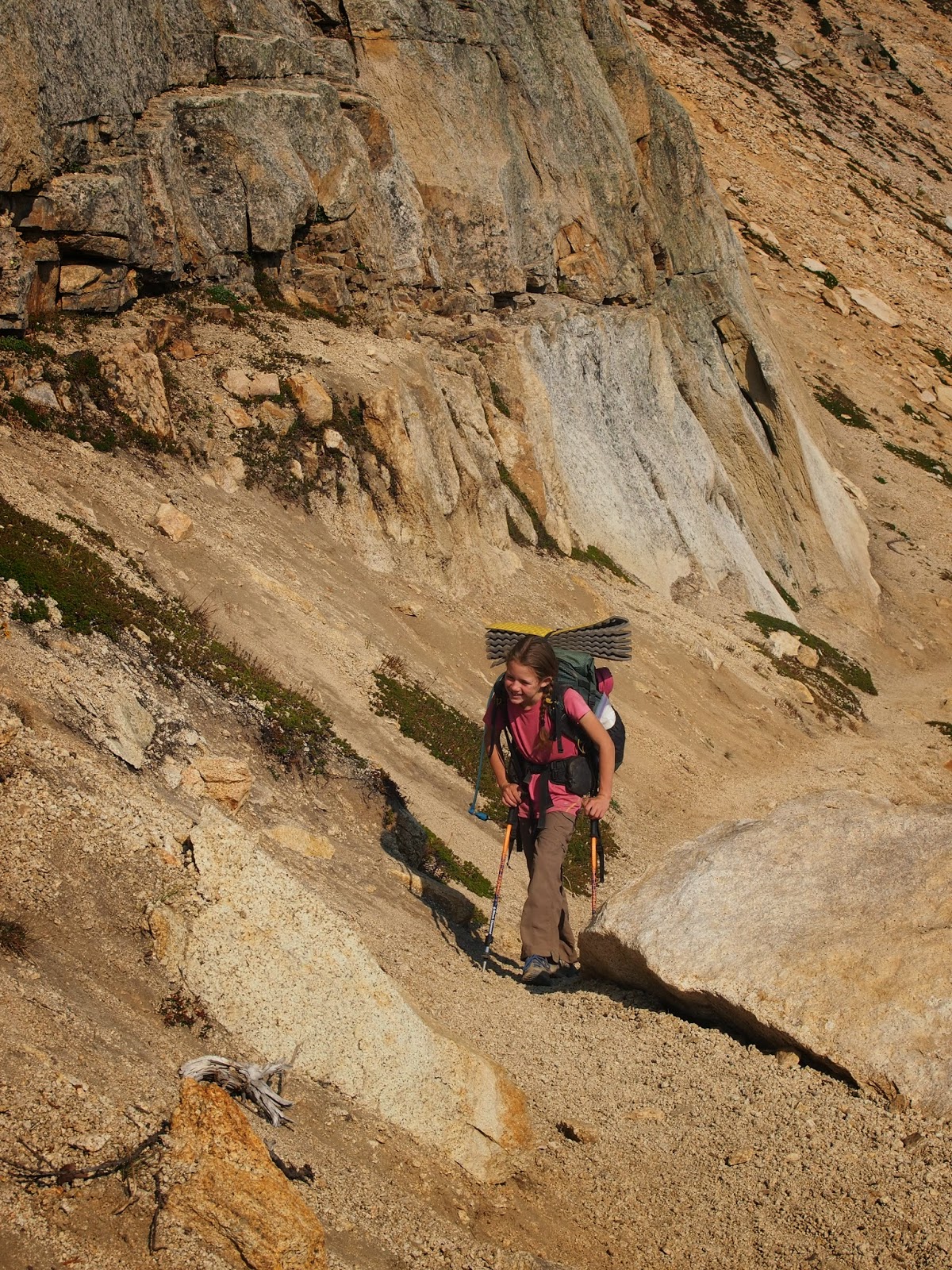
From the crest we descended briefly to avoid a steep scree slope before climbing again to Woody Pass. From there we traversed a rocky hillside, climbing slightly to reach Lakeview Ridge (7,126 ft), our high point of the day. Looking ahead at the mountains to the north, we wondered which of them were in Canada.

With mixed feelings -- both excited and sad that this incredible journey is coming to an end -- we began our descent to the border. With less than a mile left to go, I spotted a familiar figure down the trail. "Daddy!" Sierra screamed. We had not seen him since we left Ashland on August 11, six weeks ago.

Together, the three of us continued to the border. Jeff and I were deep in conversation when I heard a shriek up ahead. Sierra had discovered Monument 78 (4,240 ft), the PCT monument that marks the border between the United States and Canada!

But the trail doesn't end at the border. So, after a short celebration we continued down the trail to Manning Park, British Columbia, Canada.

We reached the trailhead parking lot with mixed emotions. We were excited that we had accomplished what we set out to do: we hiked the entire official PCT with no flips, no skips, no shortcuts or alternate routes, leaving a continuous, unbroken line of footprints from Mexico to Canada.  And in meeting that personal goal, Sierra set a new record for the youngest PCT thru-hiker, becoming the youngest person on record to have completed a continuous thru-hike of the PCT.  But our excitement at these accomplishments was tempered by other feelings: we were sad that the adventure was coming to an end.

Many hikers talk about how difficult it can be to transition from the trail. We feel thankful we were able to finish a little earlier than planned so we will have some time to ease the transition, taking time to explore alternate routes not taken (we want to see Eagle Creek and Tunnel Falls) and to get caught up on schoolwork.


Saturday, September 22, 2012

Day 154: Spring Near Tatie Peak to Spring Near Crest

The sun rose, a giant red orb behind a curtain of smoke. The golden larch trees shimmered as their needles caught the morning light. Rich green heather mixed with deep red grasses and leaves carpeted the ground beneath the trees. We met several day hikers as we slowly hiked to Harts Pass (6,198 ft), all of them out enjoying the unseasonably warm, Washington weather.

Signs announced trail magic at Harts Pass as we approached. Although we did not plan to stay long, we stopped to say hi. The trail angel was out replenishing supplies, so we sat down to talk to another hiker who had just returned from the border.

Two rangers walked up as we were talking. "Are you Sierra?" they asked. Bill and Patti, the volunteer rangers at Harts Pass, introduced themselves as friends of Coach Lindsay, one of Sierra's skiing coaches. What a small world!

After they left, Slick (PCT '08) returned and cooked up some delicious food. Sitting down, eating, talking, relaxing, we no longer felt the same sense of urgency to move down the trail. Two hours later, we finally started hiking again.

We spent the afternoon traversing a series of beautiful but indistinguishable passes: Buffalo Pass, Windy Pass, Foggy Pass, Jim Pass, Devil's Backbone. We enjoyed warm weather and a rich array of fall colors as we walked.

It was getting dark as we approached Holman Pass. An icy fog cloaked the pass and the valley below. Unable to penetrate the cool mist, our headlamp beams reflected back at us, rather than illuminating the trail. We climbed out of the fog and finally found camp near a spring high above Holman Pass.


Friday, September 21, 2012

Day 153: Rainy Pass to Spring Near Tatie Peak

The trail began climbing in dense forest. We crossed several creeks and streams, watching as the water cascaded over mossy, green rocks.

Approaching Cutthroat Pass (6,820 ft), we climbed into more open terrain.  From there we enjoyed clear views of the steep, rugged northern Cascade mountains. Fall colors were on full display, with golden larch contrasting with evergreens, and a rich undergrowth of grasses and shrubs in all shades of red, green, and gold.

We crossed talus fields and scree slopes as we approached Granite Pass (6,290 ft), slipping a little in the loose rocks and collecting tiny bits of sand and rock in our shoes. We then traversed below Tower Mountain, stopping briefly to talk with two hardy trail workers who were precariously balanced on a steep slope as they worked to repair a washed-out section of trail.

We climbed to Methow Pass (6,600 ft), then dropped back into the forest briefly to cross Brush Creek (4,280 ft) before climbing again to Glacier Pass (5,520 ft). Although it was already late when we left Glacier Pass, we continued on under a deep red, smoky moon.  We climbed to a second pass (6,750 ft), then slowly traversed a steep, rocky hillside covered in loose shale.

Running Wolf was already tucked away in his bivvy sack when we finally reached a campsite near a small spring. After gathering water we set up a hasty cowgirl camp, then turned in for the night.


Thursday, September 20, 2012

Day 152: Stehekin to Rainy Pass

A squirrel chattered noisily nearby, waking me as it scampered close to our camp. The Stehekin River roared as it poured through the rocky gorge below our camp. We moved sluggishly, packed up slowly, and meandered back to the trail.

Although North Cascades National Park encompasses high alpine terrain, with steep, rocky ridges and peaks, the PCT remains at lower elevations as it travels through the park. The trail passes through old growth forest of mixed evergreens and deciduous trees. Our favorite is the Western Red Cedar, a towering giant with a massive trunk covered by peeling red bark. The largest cedar we passed had an estimated trunk circumference of over 30 feet!

Despite unseasonably warm weather this past week, signs that the seasons are changing are everywhere. Fall, to be closely followed by winter, is on its way. Many of the leaves are changing colors, providing a brilliant display of reds, oranges, and warm golden tones. The thimbleberry vines are turning brown and dying back. Most of the berries are gone, although Sierra discovered four ripe thimbleberries on one of the dying vines. She brought them to me, sharing a last delicious taste of summer.

We reached Rainy Pass (4,855 ft) in late afternoon. There we met my mother and collected the final resupply of our journey. We are now carrying everything we need for our final push to Canada.


Wednesday, September 19, 2012

Day 151: Trail Past Suiattle Pass to Stehekin

We woke early and packed quickly, wanting to move along the trail before the first hikers tramped through our makeshift, on-trail camp.

We soon climbed out of the forest, passing through a large boulder field. Creeks and streams poured across the trail from underneath snowfields. A pika on a nearby rock eyed me suspiciously, then darted across the trail, its jaws clamped on a mouthful of green leaves.  Piia hiked by with Memphis, stopping briefly to share a photograph of a pine marten she had spotted in a tree near the trail.

Time pressure mounted as the day progressed. We wanted to catch the 3:00 p.m. bus to Stehekin, but knew we would have to push hard to reach it in time. But we made good time on the smooth, gently-graded trail, almost jogging downhill.

We reached the final crossing of Agnes Creek at 2:30. A sign welcomed us to North Cascades National Park, our seventh and final national park along the PCT. We crossed the bridge and hurried to the High Bridge Ranger Station and bus stop (1,600 ft), where one other hiker, Paws, was waiting.

The bus stopped at the famous Stehekin bakery and we piled out. I stared in amazement at the glass counter stocked with a delicious array of fresh baked goods. I gazed longingly at a plump loaf of fresh multigrain bread before settling on more packable treats: slices of pizza, muffins, and cookies, along with cold drinks.

Exiting the bus at Stehekin felt like entering a ghost town. Although a large group of hikers had passed through two days earlier (and many more are yet to come) the street was deserted when we arrived. We enjoyed Lake Chelan, a long, narrow lake reputed to be the third deepest in the country. Then, after taking care of a few chores and downing a hasty plate of nachos with Paws, we climbed back onto the bus to return to the trail.

After several successive late nights, we decided an early camp was in order. Rather than hike on, we found camping near the High Bridge Ranger Station and settled in for an early night.


Tuesday, September 18, 2012

Day 150: Ridge Above Milk Creek to North of Suiattle Pass

With Glacier Peak to the east there was no morning sun in our camp. We took advantage of the prolonged darkness to sleep in. Even without the morning sun's warming rays, the morning air was comfortably warm, hinting at a less than comfortable heat to come later in the day.

The trail followed the ridge, traversing across the steep grass and heather covered hillsides until we were directly beneath Glacier Peak. Water poured from the mountain in a multitude of streams, with no traces of the glacial silt that clouded many of the larger creeks and rivers. Next to the streams, bright colorful wildflowers still flourished. Elsewhere, however, the flowers were clearly past their prime, the lupines faded and wind blown, the wooly pasqueflower seed heads balding.

The trail dipped into the forest as we descended to Vista Creek. Moss carpeted the forest floor, which also housed a rich undergrowth of ferns, berry vines, other green plants, and fungi. Streams and creeks cascaded over mossy rocks as they fell to join Vista Creek (2,877 ft).

The trail from Vista Creek seemed to meander as it followed the Suiattle River downstream to the new bridge, about three miles down from the old one, which was destroyed in a flood.  The new section of trail was gently graded and passed through beautiful, old-growth forest. But the reroute added an additional five or six miles not included in the "current" edition of the Data Book, putting us further behind schedule.

By 7:30 p.m. it was getting dark and we still had not reached the top of the climb out of the Suiattle River canyon up to Suiattle Pass (5,990 ft). Using headlamps, we continued switchbacking up the trail. A tan frog hopped away from the light into the bushes as we approached. Farther ahead, two eyes steadily reflected my headlamp back at me as I recognized the outline of a large doe.

Reaching the pass, the trail opened to reveal the dark outlines of the mountains and a night sky lit with countless stars. We dipped briefly into the forest, then dropped into a steep canyon strewn with humongous boulders.

Climbing out of the canyon I heard a low growl followed by a sharp bark. I froze. Two eyes reflected my headlamp ahead on the trail. Then I heard a man's voice, calmly reassuring us that the dog would not bite. Continuing up the trail, we found the source of the voice, a man cowboy camped in the middle of the trail.

Dan, a southbound section hiker, had decided to camp on the trail after finding the last camping space occupied because the trail traversed a steep hillside and there was no other flat ground. After he warned us that the next flat camping would be several miles ahead, we decided to join him. Placing our sleeping pads end to end on the trail, we quickly fell asleep, the only time in my life I have slept ON a trail.