Saturday, June 30, 2012

Day 70: Boulder Creek to Ebbetts Pass

Rat-a-tat-a-tat-tat-tat-tat! Tap tap tap tap tap! Rat-a-tat-a-tat-tat-tat! Tap tap tap tap tap! A pair of woodpeckers echoed each other in a percussive morning song as they drilled into neighboring trees for breakfast. Farther off, a quartet of song birds lent their voices to provide the melody for our morning song.

From the broken white granite surrounding our camp, we hiked to the dark reddish brown volcanic rock that comprises Peak 9,500. We passed swampy meadows and climbed to a saddle with large rhyolite boulders (a chalky, brittle volcanic rock) a sizable snowfield. Sierra quickly climbed to the top of the snowfield and slid down on her feet, "boot skiing" or "foot skiing," a favorite activity whenever more traditional skiing isn't available.

Dropping into Murray Canyon we passed several seasonal streams with short young corn lily plants, mule's ears, and newly budding shooting stars.  Although bound to be the site of the next mosquito hatch, for now the meadows were pleasant.  A gentle breeze swayed the tall pines, which creaked and groaned as they moved.

We stopped for lunch at a shady spot near Wolf Creek, still hoping to make it to Ebbett's Pass by late afternoon.  But as the afternoon wore on, Sierra's pace slowed to a crawl, as she struggled to push on despite significant foot pain.  Watching her use her hiking poles as makeshift crutches, hobbling along on feet I knew were angry, swollen, red, and infected, I knew we could not wait for South Lake Tahoe for our zero days.  We would have to exit at Ebbett's Pass to seek medical attention.

Thankfully, a few miles before we reached the pass, we spotted a lone figure trudging up the hill toward us:  my father.  As Sierra slowly limped toward his truck, we tried to distract ourselves from our concern with the beautiful scenery.  Steep volcanic cliffs riddled with small black caves glowed a golden reddish tone in the fading light.  Tall pines rose up next to the trail.  Flowering mule's ears with cheerful yellow flowers, pale lavender Sierra daisies, red paintbrush, and a few brightly colored red and yellow columbines were among the many wildflowers growing next to the trail.  Fresh corn lilies thrived next to the many seasonal streams.

We reached my father's truck just before dark.  Although sad to be going to town early, we know Sierra's feet needed medical attention and rest.  We hope to be back on the trail at Ebbett's Pass in a few days, heading north to Canada.


Friday, June 29, 2012

Day 69: Sonora Pass to Boulder Creek

The picnic area bustled with the sounds of PCT hikers packing up.  After several late nights we were both tired, but with the sun already warming our tent, we were not likely to sleep much longer, so we began to pack up. 

As we packed up, a familiar figure walked across the picnic area to introduce himself:  a trail legend, the 75 year old Billy Goat.  With more miles in his legs than many people have on their cars, Billy Goat has hiked the Pacific Crest Trail countless times, and has completed the "Triple Crown" of hiking multiple times: the Appalachian Trail, the Pacific Crest Trail, and the Continental Divde Trail.  We enjoyed talking with Billy Goat for a while.  Before heading off to get ready for his own hike, he sang his trademark PCT song.

From Sonora Pass (9,620 ft), the trail once again began to climb.  Although we passed a few small meadows in the valley, vegetation grew sparse as we climbed higher.  White bark pines, white and lavendar phlox, lupine, and a few scattered grasses scratched out a living in the meager nutrients of the red volcanic soil.  Red volcanic rock towers and outcroppings covered the ridge like turrets on a castle. 

Reaching the Sierra crest (10,500 ft), we descended on rocky stream bed like trail past the junction to Wolf Creek Lake down into a grassy, forested valley.  Granite boulders and volcanic rock were strewn along the hillsides and the valley floor.  Despite my initial concerns about water, side streams and creeks frequently crossed our path.

Dropping into the beautiful valley with its steep broken granite walls, I thought about how much we need a zero day.  Even downhill, our pace has slowed to a crawl, as Sierra is forced to baby her red, tender feet.  As much as we are enjoying this section, South Lake Tahoe can't come soon enough!

Once down in the valley (8,100 ft), we began switchbacking our way back up the canyon wall, albeit farther down the canyon.  Climbing back into the forest, we once again found oursleves climbing over and around downed trees.  Single trees, pairs of trees, and a frustratingly slow, tall stack of four or five downed trees, all piled together.

Approaching Boulder Creek, the mosquitoes began attacking, attracted by the seasonal streams and swampy meadows that make ideal mosquito breeding grounds.  Whenever we stopped, swarms soon covered our clothing and buzzed around our ears and faces.  Nevertheless, we found a nice camp above the stream and stopped for the night, grateful for the thin layer of mosquito netting that separated us from the ravenous hordes.


Thursday, June 28, 2012

Day 68: Dorothy Lake to Sonora Pass

Camped high on a ridge above Dorothy Lake, the sun bathed our tent with its golden morning light by 6:00 a.m. A lone mountain chickadee sang a wake up call. Off in the distance a woodpecker jackhammered on a tree trunk, searching for breakfast.

Dorothy Lake Pass (9,550 ft) is not just the demarcation between Yosemite National Park and Hoover Wilderness. It also divides the white granite peaks of the High Sierra from the red rocky mountains of a more volcanic region.

Shortly after dropping from the pass we reached a new milestone: 1,000 miles. Kevin decided to mark the occasion by building a huge stone marker after watching me walk past the existing small stone marker without even noticing it. Afterward, he started building a large stone cairn. Carson kept adding more rocks to the pile, balancing smaller and smaller stones until he created a tall tower, earning the trailname Jenga.

We stopped for lunch at quiet stream just before Kennedy Canyon Creek, the last water for some time. Then we began the long rocky climb to the ridge. Spotting our first snowfield of the day, Sierra and her Uncle Kevin raced up the hill to it. Carson and I didn't even notice who arrived first in the flurry of snow that followed. Snowballs flew in hair and ears, at legs and arms, and down the backs of clothing.

Cooled by the snow melting all over our clothing and bodies, we climbed up to the ridge (10,880 ft). Digging into the snow patch there, we filled our cups with clean snow and made orange Gatorade slushies. Mmmmmm.

The ridge was blustery and cool, with strong gusts. The trail crossed the ridge several times, offering temporary respite, only to send us back to the windy, exposed ridge once more.

The final descent to Sonora Pass (9,620 ft) is usually a quick, heart-stopping glissade down the steep ridge.  Hikers use ice axes to slow themselves, hoping to avoid the rocks as they fly down the hill to more gentle terrain. But the ridge and descent were bare, so we followed the trail on its long traverse across the top of the steep bowl, then down a side ridge to the pass.

We shared pizza and salad (courtesy of my father, who was picking up Kevin and Carson) and more yummy cookies baked by my niece Krista. Then we set up camp, and Kevin and Carson loaded into the truck, heading for home.


Wednesday, June 27, 2012

Day 67: Kerrick Canyon to Dorothy Lake

Why DO mosquitoes buzz in your ears? At first light the mosquitoes began to whine and drone, circling our heads and dive bombing the insides of our ears. We left camp wearing raingear, as much for bug protection as for warmth.

The golden early morning sunlight bathed the steep white granite canyon walls with a golden glow. We descended the canyon following the creek past grassy meadows where corn lilies and mule's ears bloomed with bright yellow flowers.

We waded across Stubblefield Creek (7,940 ft) and began climbing up to MacComb Ridge (8,910 ft), following exposed granite terraces past gnarled junipers with peeling red bark swirling around their trunks. A colorful parade of wildflowers brightened our path: pure white Mariposa lilies, bright red paintbrush, pale lavender Sierra daisies, magenta and purple penstemon.

From the ridge we descended to Wilmer Lake (also referred to as Wilma Lake), swampy and forested around the edges with beautiful white granite cliffs rising steeply from one side. At 987 miles according to the outdated data book, this marked 1,000 miles of hiking for us, due to the extra 13 miles hiked on the frog reroute. But we didn't stop to celebrate. The air was so thick with mosquitoes you couldn't stretch out your hand without accidentally slapping one. Or two. Or a whole swarm.

But not far from the lake, Carson discovered a mosquito-free haven where the creek cascaded into deep pools of water, including a circular whirlpool sized for two. We stopped to soak and swim.

Similar to Lyell Canyon near Tuolumne Meadows, Jack Main Canyon rises slowly, following the creek upstream through rocky meadows and grassy forests. We made good time in this gentle terrain, reluctant to stop for too long for fear the mosquitoes would pick our bones clean. Hiking until we reached Dorothy Lake, we found a relatively bug free camp on the ridge overlooking the lake.


Tuesday, June 26, 2012

Day 66: Miller Lake to Kerrick Canyon

Rat-a-tat-a-tat-tat-tat-tat! Knock knock knock knock knock! A woodpecker drilled into the tree right above our tent. A thin coating of frost covered the tent, and small ice particles floated in Kevin's water bottle.

The sun slowly warmed our camp and dried our frosty tents. But once on the trail we disappeared into the tree cover. Hidden from the sun, our fingers and toes again felt the morning chill.

We passed Miller Lake (9,490 ft), and switchbacked through the trees down to Matterhorn Creek (8,510 ft). Reluctant to wade through the frigid waters, Kevin hiked downstream to investigate a promising log crossing. While we waited, Carson slowly stepped across, balancing on wet, slippery rocks. Sierra followed Carson, and soon we were all across.

We climbed to Benson Pass (10,140 ft), stopping to collect water from a pure mountain stream along the way. Dropping down to Smedberg Lake, we found a relatively big free granite slab by the water. Carson, Sierra, and I cooled our feet in the chilly water while Kevin joined the Polar Bear Club and took a swim.

Below Smedberg Lake we once again encountered the downed trees that have plagued us for hundreds of miles. As our pace slowed to climb over and around the trees, we developed a new theory that the downed trees had been placed there by the swarms of mosquitoes who were taking advantage of our slower pace to feast on our flesh. The mosquitoes continued to plague us as we passed by Benson Lake and climbed to the top of Seavey Pass. There a beautiful lakelet (read: mosquito infested swamp) reflected granite mountains glowing with the golden light of the afternoon sun.

Having already donated blood, we decided to continue down the trail to Kerrick Canyon (7,960), hoping for a less buggy camp. But after hiking a few miles down the steep, narrow canyon, we found ourselves hoping for any camp at all. Eventually the canyon widened, and we found camp near the creek. A fire (our second on this trip) kept the mosquitoes at bay while we ate dinner, and by the time we went to bed, the mosquitoes had too.


Monday, June 25, 2012

Day 65: Tuolumne Meadows to Miller Lake

Every cubic millimeter of my empty stomach craved a hot breakfast at the Tuolumne Meadows Grill. But the grill didn't open until 8:00, and we all wanted to get on the trail by 7:00. So I stuffed my pockets with bars and snacks, resigning myself to yet another cold breakfast.

Starting from the campground we crossed the road and headed up to Soda Springs, where naturally carbonated water bubbles up from the ground. Then we followed the Tuolumne River through the forest, stopping to admire the golden morning light on Cathedral Peak and other peaks surrounding Tuolumne Meadows. Winding our way down past the waterfalls, we soon reached Glen Aulin, a popular hiking destination and one of the High Sierra Camps.

From Glen Aulin we climbed gently past rocky terraces and through forest, that meandered through a beautiful grassy meadow surrounded by granite domes and peaks just in time for lunch. We sipped pure mountain water from a side stream. After lunch we soaked tired feet in the quiet creek in the center of the meadow.

Passing through the meadow we entered a mixed forest of hemlock, fir, and pine. Near Virginia Creek, we climbed over and around numerous fallen logs before finally discovering clear trail lower in the canyon. Wading across the creek soothed and cleaned our tired feet, preparing us for the final climb up Spiller Canyon.

We camped on a sandy ridge near Miller Lake. The temperature dropped precipitously the moment the sun disappeared behind the ridge. Shivering in the cold, we quickly vanished into warm sleeping bags, ready for the night.


Sunday, June 24, 2012

Day 64: Rush Creek to Tuolumne Meadows

We climbed out of the trees by Rush Creek (9,600 ft) into the alpine meadows just below Donahue Pass (11,056 ft). A creek meandered through the meadows. Streams trickled into the creek from all directions, still fed by snow melt from the surrounding peaks.

We climbed over the rocky pass, then descended to a small lakelet for lunch, leaning up against a rock in the grassy meadow to block the wind. A brave chipmunk watched our every move, inching close while pretending to look another direction, then darting away only to scamper even closer the next time.

From the lakelet we descended to Lyell Canyon. Lush green meadows full of tall grass swayed in the breeze. The Lyell Fork of the Tuolumne River slowly meandered down from the mountains. Pines lined both sides of the meadow and, in some places, encroached on it.

The canyon felt endless, but we eventually made it to Tuolumne Meadows (8,690 ft), where Jeff planned to go home and my brother, Kevin (aka Monkey's Uncle) and his son, Carson, planned to join us. They arrived with delicious cookies baked by my niece Krista, which we started eating before we even reached the campground.

We were still sorting our resupply when my friend Deb showed up and invited us to join them for food at a campsite nearby. Deb, her husband Chris, and their friend Katherine laid out an impressive array of delicious foods. We returned to camp stuffed and exhausted, but ready to start the next leg of our journey.


Saturday, June 23, 2012

Day 63: Red's Meadow to Rush Creek

Waking up to a hot breakfast is a wonderful feeling. We packed up and wandered over to the Red's Meadow cafe, arriving just after it opened. Less than an hour later we hiked out, feeling full at last.

Following the trail from Red's Meadows (7,700 ft) felt like entering a war zone. Corpses of dead trees were strewn about and piled throughout the valley. Crews of young workers from the SCA (Student Conservation Alliance) hefted large axes and spread throughout the valley to work on the wreckage.

We reached the forested Agnew Meadows by lunch, stopping to eat on a log. A curious blue jay hopped from log to log, watching while we ate.

After lunch we started to climb, then traversed along the hillside. Looking back we could see Mammoth Mountain, too far away to see the people we imagined would be mountain biking there. We also looked west across the canyon to see Shadow Lake, Mount Ritter, Banner Peak, and the Minarets.

Arriving at Thousand Island Lake, the wind gusted across the exposed granite landscape. The wind whipped across the water, creating whitecaps. Waves crashed against the rocky shore.

We continued to climb up to Island Pass (10,200). We found a nice sandy campsite by one of the lakelets, but the wind howled overhead, swaying the gnarled foxtail pines that surrounded the camp. We decided to move on, eventually finding more sheltered camping near Rush Creek, on the other side of the pass.


Friday, June 22, 2012

Day 62: Virginia Lake to Red's Meadow

The morning felt brisk and cold. Neither of us really wanted to venture out of our cozy, warm sleeping bags. Eventually, with a backward glance at the mountains reflected in Lake Virginia (10,314 ft), we got on the trail.

Once again, piles of downed trees slowed our progress as we passed through Purple Lake and beyond. We soon grew tired of climbing over and around the fallen trees. And we passed nervously beneath the precariously balanced giants, uprooted but still somewhat upright, leaning against the branches or trunk of living trees.

Just before lunch we reached the 900 mile marker! We stopped for lunch at Deer Creek and were amazed to find that trail crews had already cleared the downed trees from there to Red's Meadow. (Cleared means that the trail crews cut away the section blocking the trail. The downed trees still cover the backcountry, providing a potentially dangerous fuel load for future fire seasons.)

We knew we were nearing Mammoth by the volcanic rock lining the trail. Shortly after lunch, the Red Cones came into view. Then we spotted the gondola building on top of the bare white volcanic rock ridge crowning Mammoth Mountain, and we knew we were almost there.

We met Jeff on the final switchbacks into Red's Meadow Resort (7,700 ft), which had just opened its restaurant and store to hikers and trail crews yesterday or the day before. The road remained closed, however.  It felt strange to set up camp in the deserted car campground.


Thursday, June 21, 2012

Day 61: Vermillion Valley Resort to Virginia Lake

The sunlight filtering through the trees into our tent woke us, but we snuggled back into our sleeping bags, happy that the ferry schedule dictated a slightly more relaxed morning schedule. Eventually we stretched our way out of our bags, packed up, and headed over to the Cafe for one last magical meal. Desert Fox and Masa, a hiker from Japan, joined us.  That Guy, Helicopter, and several other hikers also squeezed into the small cafe to enjoy Roy's fine cooking.

After breakfast we finished packing up and raced to catch the ferry. A forest service ranger checked permits on the ferry. He was the first ranger we have seen in 877 miles.

Several other hikers were waiting to catch the ferry to VVR, including Legion and Steady.  We enjoyed catching up with them briefly.  Then we climbed back up to the trail from the ferry dock (7,850 ft), and continued climbing up toward Silver Pass. We paused briefly as we passed the junction to Mono Pass, knowing we could reach the Pie in the Sky Cafe at Rock Creek Lake by the end of the day. Mmmmmm, pie!

But we continued up the PCT, paralleling the North Fork of Mono Creek for much of the climb. On the lower, steeper stretches of the climb, the creek cascaded and tumbled over smooth polished granite. Reaching Pocket Meadow, the climb eased up, and the creek meandered slowly through the meadow. But where we crossed the creek, above the meadow, the creek was roaring again, although not nearly as fiercely or as deeply as the last time I had crossed it.

We stopped for lunch beneath the Silver Creek waterfalls and ate our lunch while watching the water tumbling down the steep cliffs. Then we continued to climb, past Silver Pass Lake, set in a high, rocky alpine meadow just below Silver Pass, and finally up to Silver Pass (10,900 ft) itself.

Dropping below treeline on the other side of the pass, we soon found ourselves climbing over and traversing around the many fallen trees. We also carefully avoided several trees that were uprooted and leaning precariously on other trees, but had not completely fallen yet. The mosquitoes seemed to sense when these obstacles slowed our pace, swarming around us at the times we were most helpless to defend ourselves.

The mosquitoes grew thicker as we reached the damp, grassy meadow of Tully Hole (9,520 ft). The handful of groups camped there all wore mosquito netting or built fires to drive the mosquitoes away. With no desire to camp near a mosquito infested swamp (beautiful though it may be), we pushed on up the hill to Lake Virginia (10,314 ft).

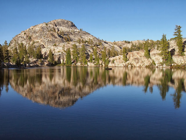
The setting sun gave a pink glow to the mountains, which were beautifully reflected in the lake's still waters when we arrived. Nestled behind a stand of foxtail pines, we found a nice sandy campsite overlooking the lake and settled in for the night.


Wednesday, June 20, 2012

Day 60: Bear Ridge to Vermillion Valley Resort

We woke early, eager to get to the ferry dock in time to catch the 9:45 ferry to Vermillion Valley Resort, where we planned to resupply and take a "near-o" day (near zero day). Despite dodging more downed trees, we made it down Bear Ridge's seemingly endless switchbacks and reached the Mono Creek bridge by 8. From there we took the side trail to the ferry dock (7,850 ft).

Several other hikers were already there, waiting. While Sierra and I made hot chocolate, three of the guys dove, launched canonballs, and did back flips from the dock into the cold lake water.  As we waited, more hikers joined us, including Desert Fox, Masa (a hiker from Japan), and Chris. Soon we spotted the ferry moving across the lake toward us.

The ferry whisked us away to Vermillion Valley Resort, where we enjoyed showers, clean laundry, and food. Lots of food. We ended the day full, relaxed, and happy.