Thursday, June 30, 2016

Day 16: Reserve Near 0 Day

We woke to the happy prospect of a real breakfast at the Adobe Bakery and Cafe in Reserve. Melt-in-your-mouth multigrain pancakes, savory home fries, and delicious omelettes started our day off right. 

Then we headed over to the local store, Jake's, to pick up a few supplies for the next two legs of our journey. They keep a large poster on the wall as a registry of CDT hikers who have stopped by. We added our names, and enjoyed looking at the many names of friends who had stopped by. 

After spending most of the day relaxing and completing town chores, we ate a quick dinner, and then headed back to the trail in the rain. We hiked in only a short way before setting up a hasty camp for the night. 

Wednesday, June 29, 2016

Day 15: Snow Lake to Highway 12 (Reserve)

Water. We woke up thinking about water. We thought about water as we hiked. We hesitated by Dutchman Springs, now little more than a muddy waterhole. But, realizing there would be a muddy cow pond later in the day if our second water cache didn't work out, we hiked on. A mile later we were relieved to find that our carefully stashed water was still there.

We spent the morning cruising along well established trail through the forest. Herds of elk, including a small group of males with towering antlers, grazed by the trail. Their loud cries filled the air whenever we approached. Then they thundered deeper into the woods. 

And then it all ended. Our lovely, well maintained trail abruptly ended in the middle of the forest. We pulled out the GPS to navigate our way along the unsigned route, but quickly put it away when it began to pour. 

We squished along in the woods for an hour or so, eventually connecting to better trail just as the storm slowed down. Thick mud clung to our shoes, creating tall platforms. 

We followed the trail down to the drier golden hills until we reached Highway 12. We will spend the night in the tiny town of Reserve, and return to the trail tomorrow. 


Tuesday, June 28, 2016

Day 14: Snow Lake to Near Dutchman Spring

After days of scrambling to find the best route as we slowly worked our way up the Gila River, we looked forward to easier travel in more open country. So it was ironic that today's hike started with a largely cross country route following a dry stream bed. Aspen trees rustled on  a hillside scattered with red paintbrush, pale lavender wild irises, and other wildflowers. 

Eventually we climbed out of the stream bed onto a forest service road through rolling ranch land. Antelope bounded across the golden hills. We crossed the hills and climbed into the Gila National Forest, with tall, shady pines. 

A bolt of lightning touched down in a clearing ahead. We watched the thunderstorm, glad it was still several miles away. We continued to watch the lightning, grateful that the storm seemed to be moving in the opposite direction. 

A lone cyclist pedaled toward up. The flashlight taped to his helmet, as much as the gear lashed to his bike frame, marked him as a Tour Divide rider. He stopped for a few minutes. 18 days in, he does not plan to stop for more than brief cat naps before he reaches the border. He wheeled off, hoping to complete the next section before the rain made the trail thick with mud. 

After three days along the Gila, it felt strange to be worrying about water again. Nevertheless, we had cached water in two places along this dry section. Reaching the first cache, we were disappointed to see that the water was gone. Carefully rationing our remaining water, we trudged on. 

Herds of elk casually sauntered across our path, the young staying close to the females. A well fed bear with a lush brown coat froze when he saw us, then lumbered into the woods. We fell asleep to flashes of lightning, the yips and howls of the coyotes, and the cries of the elk. 


Monday, June 27, 2016

Day 13: The Meadows to Snow Lake

Eighty-five crossings. Twenty-one miles. One long day. 

Squishing into sodden shoes, we packed up at dawn. The pale pink clouds to the east faded as golden light warmed the western canyon wall. 

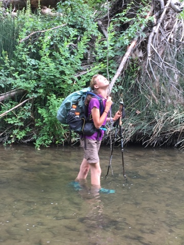
Above The Meadows, the canyon narrowed. We bounced back and forth from one side of the river to the other like pinballs. Sometimes we hiked only 10 yards before crossing back over to the other side. Occasionally we just stayed in the river, rejoining the trail when it reappeared.

Several families of ducklings frolicked on the water. Wild turkeys and great blue heron fed nearby. Two young elk eyed us warily, then raced into the woods. Deer bounded across the river as we approached. 

We ducked into a shady cave for lunch to avoid the scorching sun.  An hour later, dark clouds towered overhead, blocking the sun. A strong gust of wind dropped the temperature 10 degrees, thunder rumbled nearby, and the rain began. We waded across to a rocky cave for shelter, but soon continued up the trail. The irony of wearing rain gear to stay dry while wading through a river was not lost on us. 

We played hide and go seek with the trail all day. The trail repeatedly disappeared into rocky cliffs, walls of thick willows, or thickets of poison ivy. All the while we remained distracted by the incredible beauty of the canyon: the lush green plants, the colorful wildflowers, the spires and towers on top of the vertical cliffs of the canyon walls, the meandering river teeming with fish, frogs, and invertebrates, the countless animals and birds. 

Nevertheless, I breathed a sigh of relief when we finally climbed out into the wide open spaces of the rolling hills surrounding Snow Lake.  The Gila was incredible, and we definitely want to go back when we have more time to explore. 


Sunday, June 26, 2016

Day 12: Gila Cliff Dwellings to The Meadows

Footprints cover the sandy trail. Human footprints. We are now hiking up the Middle Fork of the Gila River in the Gila Wilderness, the first designated wilderness area at the urging of Aldo Leopold, then working in the area as a young forester. 

Over 100 crossings. We've been told to expect more than 100 river crossings along this section of the Middle Fork of the Gila River. We cross almost immediately. One down, 99 to go?!

Farther up the canyon, steam rose from pools in the creek. We stepped into a warm bath, letting the steam rise to our faces. The Gila Hot Springs. Above, cool dark caves back on in the reddish tan cliffs. 

Bzzzzzz. As I crashed through an overgrown section of brush, a short warning rattle alerted me to danger. Bzzzzz. Do I step back into the poison ivy or forward into range of the angry rattlesnake?  My decision was made easy as I glanced down to see the rattling tail slithering away into the brush. Later in the day a second rattlesnake would take more of a "stand your ground" approach, rattling angrily while coiled and ready to strike until we cautiously backed away in retreat. 

A few miles up the trail, we are met with a strange sight. Another human. The first human we've seen on the trail since we started at the Mexican border. Tamara, or "Tamale" as she is sometimes known on trail, works for Arizona Trail and was out for a quick weekend jaunt. It is her first time at the Gila and she seems just as amazed as we are. By the end of the day, we would see more than 20 people, covering the gamut from experienced locals like Ryan aka Tramper to new hikers carrying uncomfortable army surplus packs. 

Lush and green, the canyon teems with life. We step carefully through each crossing to avoid schools of Gila trout, tiny tadpoles, or anxious frogs. A young deer laps water at the river. Butterflies flit from one golden sunflower to the next. Grouse grunt incessantly, hoping to find a mate. We wonder whether the constant grunting noise actually attracts the females or if the females join the males just to get them to finally be quiet. 

We stopped for lunch at Jordan Hot Springs, where a waterfall of naturally hot water tumbles into a crystal clear pool. The hot water soothed tired muscles and relaxed us until we almost forgot we needed to get back on the trail.

Lower in the canyon, the walls rose up like a castle, topping out in rocky spires and turrets. Farther up the canyon, the steep canyon walls reminded me of the columnar basalt at Devils Postpile National Monument.

Frequent river crossings, deep sand, rocky dry river bottom, downed trees, spectacular views, friendly hikers, and prolific poison ivy all conspired to slow our progress. Reaching The Meadows, a gorgeous grassy valley ringed with tall pines and rugged, vertical rock walls, we decided to camp.


Saturday, June 25, 2016

Day 11: Gila Cliff Dwellings National Monument

Sleeping in on a zero day always feels so luxurious. But it very rarely happens. This morning, an amorous grouse, persistently calling out to potential mates, woke us with the sun. 

After a relaxing morning in camp, we headed up the road to Gila Cliff Dwellings National Monument. And yes, by headed up the road, I mean we walked (so not technically a zero day). 

The Gila Cliff Dwellings were once home to a group of ancient Puebloan people. Built inside natural caves high on the cliffs that form the rocky canyon walls, the cliff dwellings are cool in summer and provide protection from the elements in winter. Archeologists are not sure why the Puebloan people left the area, but believe the dwellings were abandoned in the early 1300s. 

After touring the cliff dwellings, we returned to camp and enjoyed a long, luxurious soak in the hot springs while Carla, one of the owners, told us a little more about the area. Then, back to camp for dinner and relaxation. 


Friday, June 24, 2016

Day 10: Tadpole Ridge to Gila Hot Springs

They say the early bird gets the worm. We woke early, hoping to get a head start on our 25 mile, partially off trail route to Gila Hot Springs. And what did our early start get us?  Lost. 

Our trail disappeared into the woods, and our GPS proved to be no help, positioning us on a steep hill. We eventually found the trail, but lost the advantage we hoped to gain with our early start. And we would need every advantage to get through the Gila before dark. 

Entering the beautiful river canyon of the Gila after days of hiking through the desert is like entering a magical world. The river meanders through a lush, green canyon with steep red rock walls. Wild turkeys, deer and other animals make those homes there. The river teems with fish, tadpoles, and frogs.  Pockets of warm water mix with the cold due to several natural hot springs flowing into the river. In places, the force of the water has carved caves into the steep, rocky cliff walls. 

The trail, such as it is, disappears and reappears constantly, leaving you to fend for yourself through thick brush or over rocky terrain. The steep canyon walls necessitate frequent river crossings. We didn't count, but some have counted as many as 56 crossings on this 14 miles stretch of river.  

We stopped for lunch on our own private sandbar island, dipping into the water whenever the heat of the sun became too much. Then we continued our long, slow trek up river. 

A long, low rumble interrupted our thoughts. Awed by the beauty of the canyon, we had not noticed the angry thunderheads piling up overhead. The sky opened and it began to pour. After more than a week of worrying about water through hot, summer desert hiking, we are now surrounded by it. 

With the rain, clumping mud, and wet progress, progress slowed even further. We made our final crossing by headlamp, then quickly walked up the highway to Gila Hot Springs Resort, where Jeff had secured a campsite by the river. 


Thursday, June 23, 2016

Day 9: Silver City to Tadpole Ridge

CDT hikers leaving Silver City are faced with a choice: hike the Gila River or follow the official CDT through the Black Range. For most hikers, the choice is easy. The Gila's beauty is legendary. And it provides one of the first natural water sources since leaving the border. But the Black Range, while hot and dry, hugs the actual divide. And it is the official route.  And we are purists. Until now. 

After our experience rationing water while hiking in the 104 degree heat in the desert, an experience that killed four people in the Phoenix/Tuscon area this weekend, we are nervous about running out of water in the Black Range in the summer heat. After over 150 miles of hiking, we have not yet passed a natural water source, and even many of the ranching sources are drying up. Running out of water in the desert heat in summer is not a risk I am willing to take. So we are heading to the Gila. 

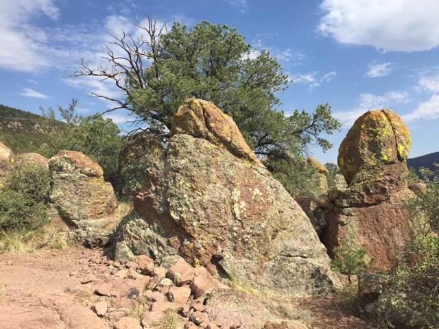
We started hiking on well maintained trail, then veered off onto a series of Jeep roads that slowly brought us closer and closer to the Gila. Red rocky cliffs towered above, and lichen covered hoodoos and other colorful rock formations filled the valley. Pines and junipers lined our trail. Gusts of wind pushed on our backs, propelling us up the canyon, even as thunderheads piled up overhead. 

We cruised up the canyon at a steady pace, stopping briefly to glance at the GPS. Oops!  Over a mile off track. We quickly backtracked to the invisible junction, easily missed. We pressed on, following a disappearing single track up a different canyon. 

If I thought our water concerns were over, I was mistaken. Our first potential source, Bear Creek, was dry in places, and consisted of a few stagnant pools in others. We hiked past, planning to fill up at one of the other other creeks or springs listed in the data book. But the other sources were all dry. We passed dried creek beds and springs, brushing past poison ivy as we pushed on in the heat. 

By dinner time I was carefully rationing my last half liter, with the next reliable source of water, a cow tank, still at least four miles away. We pressed on, following bear tracks, the only other tracks still visible in the sandy dirt. 

Sierra's joyful cry alerted me there was water ahead, a small spring -- little more than a murky puddle-- next to the trail. We slowly scooped up several liters of water before continuing up the steep trail. We reached the top of the ridge just as the sun was setting, and made a hasty camp. 


Wednesday, June 22, 2016

Day 8: Second Crossing to Silver City

Roadwalking. Hard, rocky chip and seal pounding against our feet. Heat radiating off the pavement. The heavy stench of roadkill. 

But the CDT is still a work in progress. Currently, miles of the CDT are routed along existing roads. The trail changes each year as new sections of trail are built and new easements are negotiated. Things change so quickly that the CDT GPS app I downloaded several months ago is already out of date due to a new section of trail opening up in this area. 

In the meantime, we are trying to make the most of our road walks, enjoying the unusual sights we would not notice if we were passing through at highway speeds. Lavender thistles, bright yellow daisies, and other wildflowers. A long driveway lined with abandoned toilets, reminding me a little of a scene from The Help. And, of course, easy access to cold drinks and snacks.  Mango Slush Puppie anyone?

I duck into a gas station mini mart to pick up some icy sodas. Glancing into the first cup, I notice countless tiny ant corpses. The lady at the counter confirms that the machine is infected. Disgusted, I walk out. We chat with a free spirited hobo for a few minutes before heading across the street to the Visitors Center to find a shady spot for lunch. 

"Hey kids!"  I turned to see an officious looking man glaring down at us. "Are you from around here?" "No," I replied. "Oh, I thought you were from here," he insisted, eyeing us warily as if he thought we were a pair of teenaged troublemakers. "No, we're not," I repeated. After another moment, he walked away, his tangle of keys jangling with every step. But the woman inside the Visitors Center was super friendly and accommodating, making it clear that despite our earlier encounter, hikers are welcome in her town. 

We finished our roadwalk, then went back into town to resupply and, of course, eat ice cream.